Category:Seal Point Lighthouse
Jump to navigation
Jump to search
| Object location | | View all coordinates using: OpenStreetMap |
|---|
| This category shows a South African Protected Site with SAHRA file reference 9/2/044/0004 See also: External entry in South African Heritage Resource Agency database. |
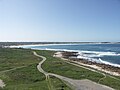
English: Seal Point Lighthouse
lighthouse at Cape St Francis in South Africa   | |||||
| Upload media | |||||
| Instance of | |||||
|---|---|---|---|---|---|
| Location | Cape St. Francis, Kouga Local Municipality, Sarah Baartman District Municipality, Eastern Cape, RSA | ||||
| Service entry |
| ||||
| Inception |
| ||||
| Source of energy | |||||
| Height |
| ||||
 | |||||
Media in category "Seal Point Lighthouse"
The following 17 files are in this category, out of 17 total.
-
 Cape St Francis (392180921).jpg 1,903 × 2,865; 479 KB
-
 Cape St Francis (392202513).jpg 3,008 × 2,000; 2.37 MB
-
 Cape St Francis (392214152).jpg 3,008 × 2,000; 2.23 MB
-
 Cape St Francis (392220351).jpg 3,008 × 2,000; 1.31 MB
-
 Cape St Francis Lighthouse Seal Point.jpg 1,024 × 745; 340 KB
-
 Cape St Francis-001.jpg 3,264 × 2,448; 1.95 MB
-
 Cape St Francis-003.jpg 2,448 × 3,264; 1.89 MB
-
 Seal Point Lighthouse Lens-001.JPG 1,600 × 1,200; 545 KB
-
 Seal Point Lighthouse Lens-002.JPG 3,264 × 2,448; 1.73 MB
-
 Seal Point lighthouse, Cape St Francis date plaque.jpg 1,706 × 2,434; 501 KB
-
 Seal Point lighthouse, Cape St Francis inside the prism.jpg 1,152 × 864; 334 KB
-
 Seal Point lighthouse, Cape St Francis reflected in pool.JPG 960 × 1,280; 610 KB
-
 Seal Point Lighthouse, Cape St Francis, South Africa.jpg 1,360 × 2,048; 1.81 MB
-
 Seal Point Lighthouse-001.jpg 3,264 × 2,448; 1.92 MB
-
 Seal Point Lighthouse-002.jpg 3,456 × 2,304; 1.63 MB
-
 Seal Point Lighthouse.jpg 1,024 × 846; 368 KB
-
 St Francis Lighthouse.jpg 2,449 × 3,310; 6.36 MB
.jpg)
.jpg)
.jpg)
.jpg)


